


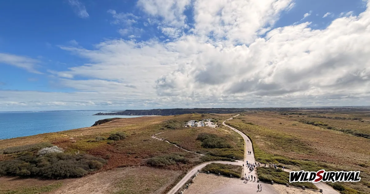
The GR34 coastal path, Brittany’s “sentier des douaniers” or customs officers’ path, follows the Breton coast for more than 2,000 km, from the bay of Mont-Saint-Michel to Saint-Nazaire, according to the French Hiking Federation. At around 20 km a day the whole GR34 coastal path takes roughly a hundred days, so almost everyone walks it in sections of one or two weeks. Spring and September are the recommended seasons, there is accommodation in most coastal towns, and camping on your own is banned on the seashore unless an exemption applies, which means a walk on the GR34 coastal path Brittany offers is planned around campsites, gîtes and B&Bs.
Contents
Why it is called the customs officers’ path
Where the trail starts and where it really ends
Splitting the coast by département
Daily distances and how much climbing to expect
The best months on the Breton coast
Where to sleep and how to send your bags ahead
Wild camping on the seashore and French law
Why it is called the customs officers’ path
The path dates from 1791, when it was created for customs patrols watching the coast day and night for smuggling and the looting of shipwrecks, as Tourisme Bretagne, the regional tourist board, explains on its GR34 page. Once the patrols stopped in the early 20th century, the track that would become the GR34 coastal path fell out of use. Enthusiasts brought it back to life in 1968 as a walking route, and the first red and white GR waymarks went up near Lannion.
The French Hiking Federation, known as FFRandonnée, also dates the start of the waymarking to 1968. It adds that the original line ran further inland, while today’s route is entirely coastal, held close to the water by the legal right of way along the shore. In 2018 the trail was voted France’s favourite GR in the federation’s own contest, with almost 24% of the 55,000 votes cast.
Where the trail starts and where it really ends
The FFRandonnée route page for the GR34 describes a one-way trail of 2,000 km. It leaves the bay of Mont-Saint-Michel, follows the bay round to Cancale, then passes Saint-Malo and Saint-Brieuc before the Goëlo coast and the Pink Granite Coast. Further west, the GR34 coastal path reaches Brest, the Crozon peninsula, Douarnenez, the Pointe du Raz and the Pays Bigouden, and then Lorient and the Gulf of Morbihan in the south.
The finish line is where sources disagree, and the federation’s page is not consistent with itself. Its introduction has the GR34 coastal path reaching Saint-Nazaire. A later paragraph ends it at the Arzal dam on the Vilaine river, then carries on along the coast through Guérande to Saint-Nazaire. Tourisme Bretagne puts the end at the Saint-Nazaire bridge. Since the federation is the body that approves and waymarks GR trails, we go with its version: more than 2,000 km from the bay of Mont-Saint-Michel to Saint-Nazaire.
Near Arzal the federation also points out two junctions. A regional loop between the Brière marshes and the Vilaine heads into the Loire-Atlantique, and the GR39 sets off towards La Roche-Bernard. The GR39 follows the Vilaine up to Rennes and then links back to Mont-Saint-Michel, so you can combine the two trails into a full tour of Brittany on foot.
More articles on WildSurvival
- Quinzhee Snow Shelter: How to Build One That Holds
- Stevenson Trail: Walking the GR70 With or Without a Donkey
- Microspikes: Choosing Winter Traction for Icy Trails
Splitting the coast by département
The easiest way to plan a section of the GR34 coastal path is by French département. The federation places the start in the Manche, since Mont-Saint-Michel is in Normandy. The trail then enters Ille-et-Vilaine around the bay, Cancale and Saint-Malo, and crosses the Côtes-d’Armor from Saint-Brieuc to the Goëlo coast and the Pink Granite Coast near Lannion.
Finistère takes the biggest share of the route described by the federation: the Morlaix area, the Abers, Brest, the Crozon peninsula, Douarnenez, the Pointe du Raz and the Pays Bigouden. Between Brest and the Pays d’Iroise the trail is also called the chemin des Phares, the lighthouse path. Morbihan follows with Lorient, the gulf and its islands, and the Loire-Atlantique closes the route through Guérande and Saint-Nazaire.
This split matches the federation’s guidebooks, each of which covers one stretch of coast, and that makes it simple to pick a one or two week section. For a first trip on the GR34 coastal path Brittany walkers often favour, a stretch with a train station at both ends keeps the journey home easy.
Daily distances and how much climbing to expect
Tourisme Bretagne works on about 20 km a day, which puts the full trail at around a hundred days. The Brittany committee of FFRandonnée uses the same pace in its planning file for multi-day walkers, and suggests itineraries of 2 to 8 days taken from the guidebooks. Very few people walk the GR34 coastal path in one go, and many come back year after year to add another section.
The route stays close to sea level, and it still asks for stamina. On the GR34 coastal path, short climbs and drops follow each other all day, and the regional committee warns that it is common to rack up 1,000 m of ascent in a single stage, often in steep bursts over short distances. Tourisme Bretagne says most of that climbing sits between Mont-Saint-Michel and the Pointe du Raz.
So a 20 km stage on the north coast can take much longer than a flat walk of the same length. Our guide to walking time and Naismith’s rule shows you how to add the climbing to your daily estimates before you book a single night.
The best months on the Breton coast
The federation lists the GR34 coastal path as walkable in every season of the year. The regional committee adds a caveat: some stretches turn wet and muddy in autumn and winter, which slows you down and makes the descents to the coves slippery. If you go between October and March, wear footwear that grips in mud.
Tourisme Bretagne calls spring, from mid-April to the end of June, the ideal window, and also recommends September, when the paths get quieter again. In July and August, book every night of your section before you set off, because you will be walking from town to town with no legal fallback of pitching a tent on the shore.
Where to sleep and how to send your bags ahead
Along the GR34 coastal path, Tourisme Bretagne lists gîtes, campsites, B&Bs and small hotels in many of the towns on the route. Some carry the “Rando Accueil” or “Étape Rando Bretagne” labels, aimed at walkers who arrive on foot and leave the next morning. The FFRandonnée Brittany committee also points walkers to the regional tourism site and its own guidebooks to find a bed.
The committee warns that some stages of the GR34 coastal path run long in areas with little accommodation. Spot those gaps before you leave, because that is usually where you have to choose between a very long day and a detour inland.
If you would rather not carry everything, luggage transfer services exist, often arranged on request through your hosts. The committee also mentions packaged trips, self-guided or with a guide, run by walking professionals. Walking with just a daypack makes a real difference on a coast where the climbing adds up.
Wild camping on the seashore and French law
Camping next to the GR34 runs into a national rule. Article R111-33 of the French planning code, in force since 1 April 2017, bans “camping pratiqué isolément”, meaning camping on your own away from a campsite, on the seashore and in listed sites, unless an exemption is granted after review by the heritage architect and the departmental commission on nature, landscapes and sites. The same article covers protected sites, the surroundings of historic monuments and a 200 m radius around drinking-water intakes.
French law has no separate definition of a bivouac, and the customs officers’ path hugs the shoreline for most of its length. Town halls can also ban camping by local order, posted at the town hall and at access points, so a sign at the entrance to a beach or nature site is the rule that applies on the ground. Our guide to wild camping rules in France walks through those layers, from private land to national parks.
In practice, you plan the GR34 coastal path Brittany walkers know around campsites, gîtes and B&Bs. The FFRandonnée Brittany committee recommends campsites, of which there are plenty along the trail, to protect the edges of the path. If you really want a night in a tent outside a campsite, ask the town hall about the area first and get the landowner’s permission, well away from the shore.
Tides, currents and foreshore shortcuts
The regional committee calls the GR34 the most maritime of all the GR trails, and the tide shapes every day you spend on it. In its suggested walk around the bay of Saint-Brieuc, the federation invites you to see the bay at high tide and at low tide, and that changing view is a big part of the appeal.
The risk lies in shortcuts. If a local walking guide sends you across the foreshore to an islet or along a beach, or if you are tempted to leave the waymarks and cut across sand or rocks, check the tide time and coefficient for the nearest port first and leave yourself a margin for the way back. When in doubt, stay on the trail.
The federation’s page also flags the currents of the Raz de Sein off the Pointe du Raz, which it describes as sometimes wild. On the exposed headlands of the GR34 coastal path, wind and spray make cliff edges slick, so keep to the path even when the view looks better a few metres closer to the drop.
Guidebooks, apps and planning tools
FFRandonnée publishes the GR34 coastal path as a set of French-language guidebooks, one per stretch of coast, which also make a handy way to choose a section:
| FFRandonnée guidebook | Reference |
|---|---|
| Côte d’Émeraude, les chemins du Mont-Saint-Michel | 345 |
| Côte de granit rose, Trégor morlaisien | 346 |
| Les Abers, l’Iroise et Crozon | 347 |
| La Cornouaille par la pointe du Raz | 348 |
| Le littoral et les îles du Morbihan | 561 |
| Les portes de Cornouaille | T291 |
For maps and route details, the federation recommends its MaRando app and its MonGR website. Tourisme Bretagne points to Itirando for multi-day walking and to Ma Rando facile for logistics, from bag transfers to walking guides.
If you have already planned another long-distance trail in France, the process will feel familiar. Our piece on the Stevenson Trail and the GR70 follows the same steps of splitting the route into stages and booking nights ahead, on a much shorter path.
GR34 coastal path Brittany: the key facts at a glance
| Point | Key fact |
|---|---|
| Start and finish | Bay of Mont-Saint-Michel to Saint-Nazaire, per FFRandonnée |
| Distance | More than 2,000 km of coastline |
| Time | About a hundred days at 20 km a day, usually walked in sections |
| Ascent | Up to 1,000 m in a stage, mostly between Mont-Saint-Michel and the Pointe du Raz |
| Season | All year, ideally mid-April to end of June and September |
| Nights | Campsites, gîtes, B&Bs, small hotels |
| Camping alone on the shore | Banned unless exempted, article R111-33 of the planning code |
To get going on the GR34 coastal path, pick your section and number of days, check train access at both ends, then book every night. Keep an eye on the tide tables if you plan to leave the waymarks, and pack shoes that cope with mud outside the summer months.